
Parcel 37-1N-25-2970-0009-0020
Owners
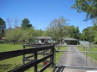
54047 ROY BOOTH RD
CALLAHAN, FL 32011
Parcel Summary
| Situs Address | 54047 ROY BOOTH RD |
|---|---|
| Use Code | 0100: SINGLE FAMILY |
| Tax District | 6: Drainage Dist |
| Acreage | 11.4200 |
| Section | 37 |
| Township | 1N |
| Range | 25 |
| Subdivision | FL LD SY R/P PBKO-44 |
| Exemptions | HX: Homestead (196.031(1)(a)) (100%) HB: Homestead Banded (196.031(1)(ab) (100%) |
Short Legal
PT LOTS 9 & 10 IN OR 2218/833(EX PT IN ESMT OR 478/26 & PT
IN R/W OR 579/196)...
Certified Values
| STANDARD | 2024 |
|---|---|
| Land Value | $171,300 |
| (+) Improved Value | $359,167 |
| (=) Market Value | $530,467 |
| (-) Agricultural Classification | $0 |
| (=) Assessed Value | $306,269 |
| (=) County Taxable Value | $256,269 |
Document/Transfer/Sales History
| Instrument / Official Record | Date | Q/U | V/I | Sale Price | Ownership |
|---|---|---|---|---|---|
| WD 2218/0833 | 2018-08-13 | Q | Improved | $345,000 | Grantor: FERNANDEZ CHARLES F & DENIS M GRAHAM (H&W) Grantee: DEAN ANTHONY V & ARONDA Y |
| WD 2032/1387 | 2016-03-01 | Q | Improved | $285,000 | Grantor: MONTGOMERY KENNETH R & KAREN M MARLEY Grantee: FERNANDEZ CHARLES F |
| WD 1740/0312 | 2011-05-02 | Q | Improved | $270,000 | Grantor: DAVIS LYNDA M Grantee: MONGOMERY KENNETH R JR & KAREN M MARLEY |
| QC 1645/1985 | 2009-10-26 | U | Improved | $100 | Grantor: DAVIS GEORGE W Grantee: DAVIS LYNDA M |
| WD 0690/0800 | 1993-10-14 | U | Improved | $118,000 | Grantor: BOATRIGHT EUGENE JR Grantee: DAVIS GEORGE & LYNDA |
| WD 0547/0030 | 1988-07-06 | Q | Improved | $82,500 | Grantor: TEDRICK PHILLIP & S Grantee: BOATRIGHT EUGENE JR |
| WD 0491/0586 | 1986-06-10 | Q | Improved | $72,000 | Grantor: EDWARDS CECILLE E ETAL & EARNHART ETHLYNN Grantee: TEDRICK PHILLIP D (MARRIED) |
Buildings
Building # 1, Section # 1, 313136, RESIDENTIAL
| Heated Sq Ft | Year Built | Value |
|---|---|---|
| 2143 | 1962 | $327,161 |
Structural Elements
Extra Features
| Code | Description | Length | Width | Units | Unit Price | AYB | % Good Condition | Final Value |
|---|---|---|---|---|---|---|---|---|
| 0504 | FP-ELECTRIC | 1.00 | $2,000.00 | 1962 | 23% | $460 | ||
| 0680 | POLE SHED WD | 26 | 12 | 312.00 | $10.00 | 1989 | 20% | $624 |
| 0511 | GARAGE CB-BRICK | 12 | 24 | 288.00 | $60.00 | 2004 | 83% | $14,342 |
| 0752 | USP | 12 | 24 | 288.00 | $15.00 | 2004 | 32% | $1,382 |
| 0200 | BARN WD 0-1000 | 35 | 33 | 1155.00 | $20.00 | 1997 | 24% | $5,544 |
| 0680 | POLE SHED WD | 508.00 | $10.00 | 1997 | 24% | $1,219 | ||
| 1242 | WD DECK A | 24 | 16 | 384.00 | $10.00 | 1996 | 20% | $768 |
| 0351 | CARPORT MTL | 24 | 20 | 480.00 | $10.00 | 1997 | 20% | $960 |
| 0350 | CARPORT WD | 21 | 15 | 315.00 | $13.00 | 1998 | 20% | $819 |
| 0350 | CARPORT WD | 22 | 22 | 484.00 | $13.00 | 1998 | 20% | $1,258 |
| 0811 | CONCRETE B | 500.00 | $5.20 | 1998 | 73% | $1,898 | ||
| 0351 | CARPORT MTL | 20 | 40 | 800.00 | $5.90 | 2004 | 21% | $991 |
| 0351 | CARPORT MTL | 24 | 24 | 576.00 | $5.90 | 2004 | 21% | $714 |
| 0350 | CARPORT WD | 20 | 41 | 820.00 | $13.00 | 2004 | 21% | $2,239 |
| 0681 | POLE SHED MTL | 9 | 11 | 99.00 | $15.00 | 2004 | 32% | $475 |
| 0940 | SHEDS/PORT | 12 | 12 | 144.00 | $30.00 | 2004 | 21% | $907 |
| 0803 | ASPHALT C | 6345.00 | $2.00 | 2004 | 52% | $6,599 | ||
| 0810 | CONCRETE A | 962.00 | $6.50 | 2004 | 83% | $5,190 |
Land Lines
Personal Property
None
TRIM Notices
Property Record Cards
Disclaimer
The Nassau County Property Appraiser's Office makes every effort to produce the most accurate information possible. No warranties, expressed or implied, are provided for the data herein, its use or interpretation. The information contained herein is for ad valorem tax assessment purposes only. The Property Appraiser exercises strict auditing procedures to ensure validity of any transaction received and posted by this office but cannot be responsible for errors or omissions in the information received from external sources. Due to the elapsed time between transactions in the marketplace, and the time that those transactions are received from the public and/or other jurisdictions, some transactions will not be reflected.